Wednesday, June 13, 2007

More From Sedona

More pictures from Sedona...


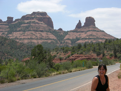
These are from the roadway down into Sedona. The road winds down about 1000 vertical feet through pines and then opens up into the red rock area.


Get a cabin dude...

Sedona

On the way home from the Grand Canyon we took the scenic route down through Sedona to Jerome (old mining town). Sedona was beautiful, but we didn't really stop. Just hopped out of the car enough to take pictures....


Alitia and Aleister:


Some red rocks...


Wednesday, June 06, 2007

Last of the Grand Canyon

This is heading back up to the top...

And finally back at the top of the canyon looking back down at the start of the South Kaibab...Kabob!


One more look at the view across to the North Rim. It is about 8 miles away straight across from rim to rim. To hike it, it would be 6 miles down to the river and then about 7 back up the other side.


The newly engaged family...and their long, lost buddy in fruity yellow.

And More...


This is the turnaround point. You can see how small the people are looking down in relation to the surroundings.


Alitia and Aleister takin' a break.


This little one was eating out of our hands, but then we realized its pretty hard to feed a baby nibbles of food when a squirrel is trying to take it from him. Then we had to give 'em the boot.


This is a good shot looking up from the turnaround point. It gives a good idea of how far down we were. The turnaround point was about 1200 vertical feet down into the canyon...and this is only about a quarter of the way down. To go to the river, it is about one mile vertical distance...6 miles hiking.

More Pictures

Another picture looking down at the rest area and trail. Looking down to the left, you can see the wonderful little hut, otherwise known as the outhouse. Thats the turnaround point 1.5 miles down into the canyon.


More looking down the trail to come...


Better watch my step...

On the Trail

More pictures...you can see the person standing on the edge of the trail as it winds down around the canyon wall.


This is looking further down the trail with a canyon view. You can see where the canyon opens up and goes even deeper. That crevice is not even where the river is. The river is so far down that we were not able to even see it from any part of the hike.

Me on the trail...


This is looking down towards the rest of the trail we were hiking on. The reddish open space on the left is the 1.5 mile turnaround. You can see where the trail continues on from there. After the turnaround point, the trail levels out a bit and isn't so steep for awhile until you get deeper into the canyon.


This is looking back up the trail at the South Rim of the canyon. Most of the other pictures are looking out into the canyon across the river at the North Rim. This part of the South Rim looked very repetitive...the water had created the exact same patterns in the rock over and over around the side of the rim wall.

Tuesday, June 05, 2007

Hiking the Grand Canyon

So when we went to the Grand Canyon, we wanted to hike down, not just look out from the viewpoints. Aaron and I did a little research and decided to do a 3 mile hike on the South Kaibab trail....kabob! It is 1.5 miles down to the first turnaround rest area, and then 1.5 miles back up. There are warning signs everywhere to beware, not hike too far, never to try and hike to the river in one day, etc. The river is 6 miles away. The temperature gets hotter as you go down further. The views from the top are nothing compared to the hike down inside the canyon. I have a newly found appreciation for nature, camping, and hiking now. It was absolutely amazing and even hiking the 3 miles gives you a feeling of accomplishment. This picture shows the start of the trail, the steepest part where we initially started down into the canyon. The walls are almost straight up, so the only way to hike down is along these switchback paths.


Once we came out of the switchbacks, the trail opens up. You can see the size in this picture....look how small the hikers are in comparison with their surroundings.


Alitia and Tiffany...


This is looking back up from partway down the trail. This picture is probably about a 1/4 mile down and maybe a few hundred vertical feet. You can see the switchback trail in the distance where we started the hike (the lighter tan colored area up in the larger rock formation).


This is zoomed in as far as the camera can go for a better view.